0%
Layers
Overlay
VIIRS
VIIRS Trend
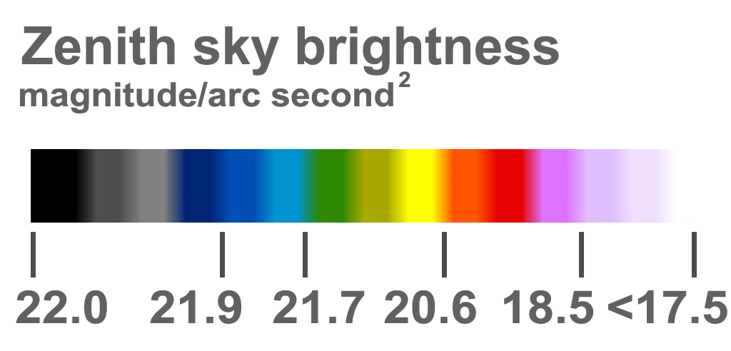
Sky Brightness
World Atlas 2015
Clouds
Aurora forecast
2025
2024
2023
2022
2021
2020
2019
2018
2017
2016
2015
2014
2013
2012
2025
2024
2023
2022
2021
2020
2019
2018
2017
2016
2015
2014
2013
2012
Color blind
60%
Sky brightness options
SQM range
-
Color
Apply
Feature
SQM
SQM-L
SQM-L(E/R/U)
SQC
Observatories
Dark sky parks
Show Day/Night
85%
SQM/SQC options
Name
Date
-
Draw points by time measured
Observatories options
Name
MPC
SQM
-
Show only 1m and larger
Show only optical
Show only radio
Show only MPC
Apply
Reset
Basemap
Google Road map
Google Satellite map
Dark mode
Tools
Geolocation
Measure distance
Print map to file
Point information (default)
Area (polygon) information
Area (circle) information
Area (square) information
Add SQM measurement
Sky brightness simulation
Find closest dark site
Moon widget (experimental)
Add a map marker
Statistics per country
Show VIIRS/SB values on hover
Legend
My locations
Edit list
New
Help
Statistics per country
VIIRS Statistics
Observatory List